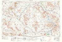
1956 Map of Needles
USGS Topo · Published 1969About this map
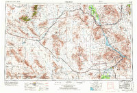
The Colorado River carves a critical boundary between California and Arizona, anchoring a desert landscape defined by massive dry basins and jagged ranges. This 1969 revision of a 1956 survey captures the eastern Mojave Desert as the postwar infrastructure of U.S. Highway 66 and the Atchison Topeka and Santa Fe RR facilitated travel through once-formidable terrain. The map details the vast expanses of Bristol Lake and Cadiz Lake, alongside localized industrial points like the Iron Mountain Pumping Plant.
Find a feature on this map
64 named features on this map. Tap any name to fly to it.
Don’t see what you’re looking for? This feature index may not catch every label — zoom into the map to look around manually.
Map Details
Editions of this 1956 Needles Map
7 editions found

Other maps of this area

1886 · Diamond Creek
USGS Topo · 1:250,000

1886 · Camp Mohave
USGS Topo · 1:250,000

1892 · Diamond Creek
USGS Topo · 1:250,000

1892 · Camp Mohave
USGS Topo · 1:250,000

1903 · Needles
USGS Topo · 1:125,000

1904 · Needles Special
USGS Topo · 1:125,000

1910 · Ivanpah
USGS Topo · 1:250,000

1911 · Parker
USGS Topo · 1:125,000

1912 · Ivanpah
USGS Topo · 1:250,000

1923 · Signal
USGS Topo · 1:250,000