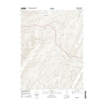
2014 Map of Needmore
USGS Topo · Published 2014About this map
Skaggs Run cuts through this high-elevation landscape in Hardy County, defining the local drainage patterns and terrain of the Appalachian highlands. This map illustrates the intersection of primary transport routes like US-48 and State Road 55 with the complex network of mountain ridges and narrow valleys. The presence of named drainages like Skaggs Run reveals how the physical geography dictated early settlement and road placement, with many secondary routes following these natural contours to navigate the steep elevation changes characteristic of this portion of West Virginia.
Find a feature on this map
1 named feature on this map. Tap any name to fly to it.
Don’t see what you’re looking for? This feature index may not catch every label — zoom into the map to look around manually.
Map Details
Editions of this 2014 Needmore Map
This is the sole edition of this map. No revisions or reprints were ever made.
Other maps of this area

1891 · Romney
USGS Topo · 1:125,000

1892 · Woodstock
USGS Topo · 1:125,000

1920 · Moorefield
USGS Topo · 1:62,500

1921 · Orkney Springs
USGS Topo · 1:48,000

1921 · Moorefield
USGS Topo · 1:48,000

1922 · Moorefield
USGS Topo · 1:62,500

1922 · Wardensville
USGS Topo · 1:62,500

1923 · Orkney Springs
USGS Topo · 1:62,500

1923 · Edinburg
USGS Topo · 1:62,500

1924 · Wardensville
USGS Topo · 1:62,500