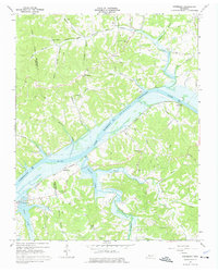
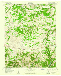
1965 Map of Needmore
USGS Topo · Published 1976About this map
Lake Barkley and the Cumberland River dominate this mid-century landscape along the border of Stewart and Montgomery Counties. The 1960s terrain shows a transition point for river commerce and local transportation, with the Louisville and Nashville railroad skirting the southern banks of the river and Lake Barkley. Significant rural settlements such as Needmore and Sailors Rest are detailed, along with several family-named hollows and creek systems. The map includes several ecclesiastical landmarks, such as Wilees Chapel, Evergreen Ch, and Mt Ararat Ch, which served as anchors for these dispersed farming communities. A U S Reservation is noted in the southwest, while the northern uplands are defined by numerous named features like Blooming Grove Creek and Stringtown. This survey captures the rural infrastructure of the era, from the winding paths of Blooming Grove Road to the presence of a Community House and a modern pipeline crossing.
Find a feature on this map
54 named features on this map. Tap any name to fly to it.
Don’t see what you’re looking for? This feature index may not catch every label — zoom into the map to look around manually.
Map Details
Editions of this 1965 Needmore Map
3 editions found
Other maps of this area

1931 · Erin
USGS Topo · 1:62,500

1936 · Tantrough Hollow
USGS Topo · 1:24,000

1944 · Clarksville
USGS Topo · 1:50,000

1951 · New Providence
USGS Topo · 1:24,000

1951 · Indian Mound
USGS Topo · 1:24,000

1951 · Woodlawn
USGS Topo · 1:24,000

1956 · Nashville
USGS Topo · 1:250,000

1957 · New Providence
USGS Topo · 1:24,000
1957 · Indian Mound
USGS Topo · 1:24,000
1957 · Woodlawn
USGS Topo · 1:24,000