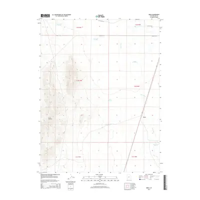
2014 Map of Neels
USGS Topo · Published 2014About this map
Neels serves as the primary landmark in this section of the Great Basin, where the stark elevation of the Cricket Mountains meets the desert floor. The landscape is defined by its water management systems, including the Beaver River and a series of man-made basins such as Neels Reservoir Number 2 and the Beaver River Reservoir. These features suggest a history of managing intermittent flows to support the region's ranching or transit needs. Transportation is anchored by the north-south corridor of Highway 257 Rd, which runs parallel to the riverbed. Additional infrastructure like Headquarters Reservoir and AT T Road Reservoir indicates the strategic placement of resources across the dry terrain, while Pot Mountain Rd provides access to the higher ground of the northern townships.
Find a feature on this map
16 named features on this map. Tap any name to fly to it.
Don’t see what you’re looking for? This feature index may not catch every label — zoom into the map to look around manually.
Map Details
Editions of this 2014 Neels Map
This is the sole edition of this map. No revisions or reprints were ever made.
Other maps of this area

1885 · Beaver
USGS Topo · 1:250,000

1885 · Sevier Desert
USGS Topo · 1:250,000

1953 · Richfield
USGS Topo · 1:250,000

1953 · Delta
USGS Topo · 1:250,000

1958 · Richfield
USGS Topo · 1:250,000

1958 · Delta
USGS Topo · 1:250,000

1962 · Delta
USGS Topo · 1:250,000

1962 · Tabernacle Hill
USGS Topo · 1:62,500

1971 · Red Pass
USGS Topo · 1:24,000

1971 · Rocky Knoll
USGS Topo · 1:24,000