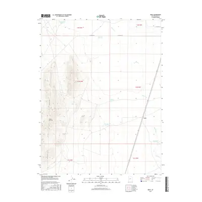
2017 Map of Neels
USGS Topo · Published 2017About this map
The Cricket Mountains dominate the western landscape of this Millard County desert region, where the dry channel of the Beaver River winds through an arid basin. The settlement of Neels sits at a strategic point along the transportation corridor that parallels the river's path, serving as a focal point in a territory otherwise defined by ranching infrastructure. A complex network of water management features, including the Beaver River Reservoir, Headquarters Reservoir, and Neels Reservoir Number 2, illustrates the historical effort to capture and control seasonal runoff for livestock and survival in the high desert. To the north, the AT T Road Reservoir and roads like W 16000 South St provide access through the vast public land survey sections. The inclusion of the Power Line Up Rd further highlights the utilitarian nature of this landscape as it appeared in recent years.
Find a feature on this map
17 named features on this map. Tap any name to fly to it.
Don’t see what you’re looking for? This feature index may not catch every label — zoom into the map to look around manually.
Map Details
Editions of this 2017 Neels Map
This is the sole edition of this map. No revisions or reprints were ever made.
Other maps of this area

1885 · Beaver
USGS Topo · 1:250,000

1885 · Sevier Desert
USGS Topo · 1:250,000

1953 · Richfield
USGS Topo · 1:250,000

1953 · Delta
USGS Topo · 1:250,000

1958 · Richfield
USGS Topo · 1:250,000

1958 · Delta
USGS Topo · 1:250,000

1962 · Delta
USGS Topo · 1:250,000

1962 · Tabernacle Hill
USGS Topo · 1:62,500

1971 · Red Pass
USGS Topo · 1:24,000

1971 · Rocky Knoll
USGS Topo · 1:24,000