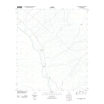
2013 Map of Neely Arroyo
USGS Topo · Published 2013About this map
Fort Quitman stands as a focal point along the meandering course of the Rio Grande on this international border survey. The landscape is defined by the drainage patterns of the Chihuahuan Desert, where numerous ephemeral washes like McClintock Arroyo and Neely Arroyo cut through the arid terrain toward the river valley. The presence of the Quitman Cem near the northern boundary and the Neely Ranch to the south suggests a long-standing human connection to this borderland, even as the population remains sparse.
Find a feature on this map
11 named features on this map. Tap any name to fly to it.
Don’t see what you’re looking for? This feature index may not catch every label — zoom into the map to look around manually.
Map Details
Editions of this 2013 Neely Arroyo Map
This is the sole edition of this map. No revisions or reprints were ever made.
Other maps of this area

1894 · Fort Hancock
USGS Topo · 1:125,000

1895 · Sierra Blanca
USGS Topo · 1:125,000

1897 · Eagle Mountain
USGS Topo · 1:125,000

1916 · Eagle Mountain
USGS Topo · 1:125,000

1943 · Fort Quitman
USGS Topo · 1:62,500

1954 · Van Horn
USGS Topo · 1:250,000

1958 · Van Horn
USGS Topo · 1:250,000

1959 · Marfa
USGS Topo · 1:250,000

1964 · Lasca
USGS Topo · 1:24,000

1964 · Sierra Blanca SW
USGS Topo · 1:24,000