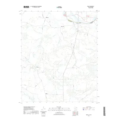
2019 Map of Negley
USGS Topo · Published 2019About this map
Negley and the surrounding Red River County landscape are defined by a complex network of waterways moving toward the Red River at the Oklahoma border. The area is marked by low-lying wetlands and numerous drainage systems including Pecan Bayou, Big Pine Creek, and Snell Cr. Small rural settlements like Silver City, Blakeney, and Albion are connected by a web of county roads and farm-to-market routes, including FM 195 and FM 2118. For genealogists and local historians, the map preserves the locations of several burial grounds, such as Haley Cem, Albion Cem, and Tuggle Springs Cem. The terrain is characterized by meandering sloughs and branches, most notably Hemmingway Slough and Little Pine Br, which illustrate the hydraulic character of this border region before the floodplain reaches the river's main channel.
Find a feature on this map
53 named features on this map. Tap any name to fly to it.
Don’t see what you’re looking for? This feature index may not catch every label — zoom into the map to look around manually.
Map Details
Editions of this 2019 Negley Map
This is the sole edition of this map. No revisions or reprints were ever made.
Other maps of this area

1950 · Acworth
USGS Topo · 1:24,000

1950 · White Rock
USGS Topo · 1:24,000

1951 · Garvin
USGS Topo · 1:24,000

1951 · White Rock
USGS Topo · 1:24,000

1951 · Acworth
USGS Topo · 1:24,000

1951 · Millerton
USGS Topo · 1:24,000

1951 · Negley
USGS Topo · 1:24,000

1951 · Kiomatia
USGS Topo · 1:24,000

1951 · Manchester
USGS Topo · 1:24,000

1953 · Texarkana
USGS Topo · 1:250,000