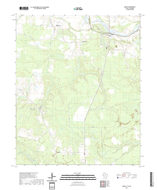
2022 Map of Negley
USGS Topo · Published 2022About this map
The Red River defines the northern boundary of this Texas-Oklahoma borderlands area, where the flat river plains meet the intricate drainage network of northern Red River County. Small rural settlements like Negley, Silver City, and Blakeney are scattered across a landscape dominated by timber and agriculture. The presence of historic burial grounds, including the Haley Cem, Albion Cem, and Tuggle Springs Cem, provides a map for genealogists tracking early families in this corner of the state.
Find a feature on this map
48 named features on this map. Tap any name to fly to it.
Don’t see what you’re looking for? This feature index may not catch every label — zoom into the map to look around manually.
Map Details
Editions of this 2022 Negley Map
This is the sole edition of this map. No revisions or reprints were ever made.
Other maps of this area

1950 · Acworth
USGS Topo · 1:24,000

1950 · White Rock
USGS Topo · 1:24,000

1951 · Garvin
USGS Topo · 1:24,000

1951 · White Rock
USGS Topo · 1:24,000

1951 · Acworth
USGS Topo · 1:24,000

1951 · Millerton
USGS Topo · 1:24,000

1951 · Negley
USGS Topo · 1:24,000

1951 · Kiomatia
USGS Topo · 1:24,000

1951 · Manchester
USGS Topo · 1:24,000

1953 · Texarkana
USGS Topo · 1:250,000