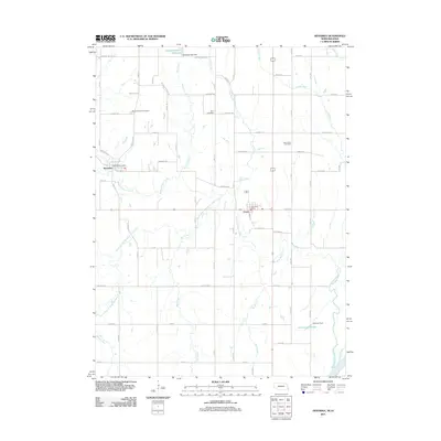
2011 Map of Nehawka
USGS Topo · Published 2011About this map
The agricultural landscape of Cass County is defined by the network of waterways feeding into the Missouri River in this 2011 survey. The village of Nehawka is established along the banks of Weeping Water Creek, while the town of Union sits further east, near the confluence of several tributaries including Coal Creek and the South Branch Weeping Water Creek. The map provides a clear picture of the rural infrastructure, noting the Nehawka Post Office and Union Post Office as central hubs for their respective communities.
Find a feature on this map
73 named features on this map. Tap any name to fly to it.
Don’t see what you’re looking for? This feature index may not catch every label — zoom into the map to look around manually.
Map Details
Editions of this 2011 Nehawka Map
This is the sole edition of this map. No revisions or reprints were ever made.
Other maps of this area

1903 · Weeping Water
USGS Topo · 1:125,000

1907 · Nebraska City
USGS Topo · 1:62,500

1929 · Weeping Water
USGS Topo · 1:125,000

1935 · Nehawka
USGS Topo · 1:48,000

1940 · Nehawka
USGS Topo · 1:62,500

1955 · Nebraska City
USGS Topo · 1:250,000

1955 · Lincoln
USGS Topo · 1:250,000

1956 · Murray
USGS Topo · 1:24,000

1956 · Rock Bluff
USGS Topo · 1:24,000
1956 · Weeping Water NE
USGS Topo · 1:24,000