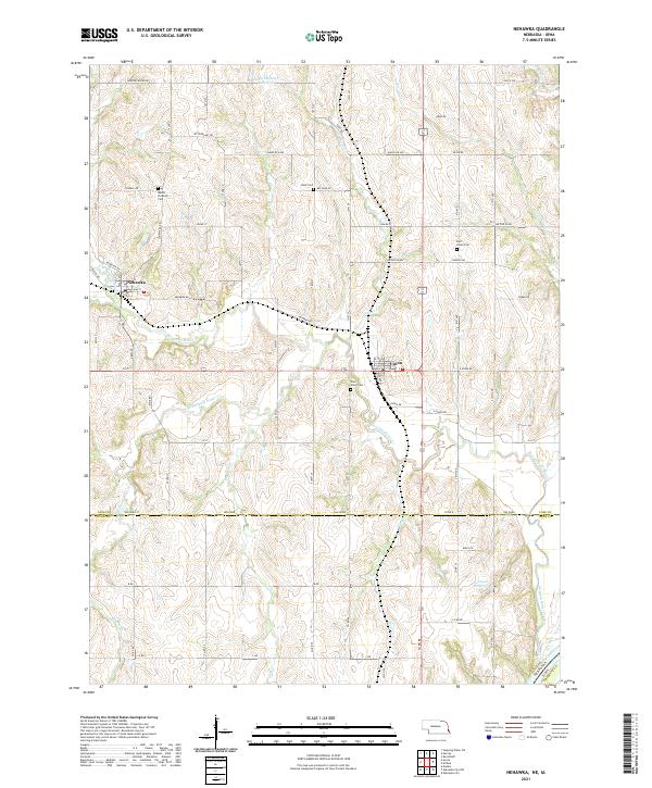
2021 Map of Nehawka
USGS Topo · Published 2021About this map
Nehawka and Union anchor this landscape along the banks and tributaries of Weeping Water Creek, which winds through the agricultural heart of Cass County and into Otoe County. The area's settlement history is etched into the terrain through a series of dedicated burial grounds, including Mount Pleasant Cem, Buck Cem, and the dual East Union Cem and West Union Cem sites. This 2021 survey illustrates how the township lines of t10n r13e and t11n r13e organize the modern road network, where routes like Havelock Ave and Adams St bridge the gaps between drainage features like Big Slough and Wolf Cr. Small reservoirs such as Schlichtemeier Reservoir and Johnson Reservoir provide local water management in a region where the meandering S Br Weeping Water Cr defines much of the southern topography.
Find a feature on this map
54 named features on this map. Tap any name to fly to it.
Don’t see what you’re looking for? This feature index may not catch every label — zoom into the map to look around manually.
Map Details
Editions of this 2021 Nehawka Map
This is the sole edition of this map. No revisions or reprints were ever made.
Other maps of this area

1903 · Weeping Water
USGS Topo · 1:125,000

1907 · Nebraska City
USGS Topo · 1:62,500

1929 · Weeping Water
USGS Topo · 1:125,000

1935 · Nehawka
USGS Topo · 1:48,000

1940 · Nehawka
USGS Topo · 1:62,500

1955 · Nebraska City
USGS Topo · 1:250,000

1955 · Lincoln
USGS Topo · 1:250,000

1956 · Murray
USGS Topo · 1:24,000

1956 · Rock Bluff
USGS Topo · 1:24,000
1956 · Weeping Water NE
USGS Topo · 1:24,000