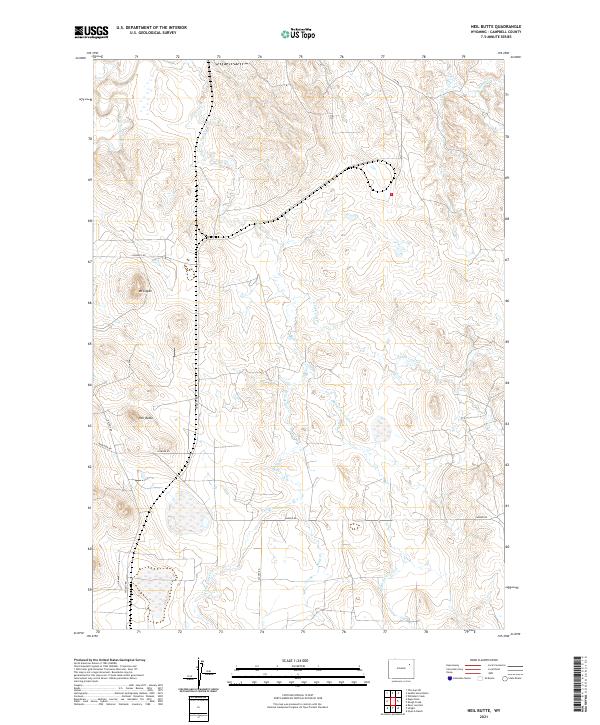
2021 Map of Neil Butte
USGS Topo · Published 2021About this map
Neil Butte and Mt Logan rise above a landscape defined by the intricate drainage systems of the Belle Fourche River basin. This 2021 survey of Campbell County captures the high plains of Wyoming where numerous seasonal waterways like Coal Cr and Dry Cr have etched a complex series of draws and ridges. The territory is carved by various branches of Coal Cr, including the E Fork Coal Cr, W Fork Coal Cr, and Middle Fork Coal Cr, demonstrating the hydrographic patterns of the region.
Find a feature on this map
20 named features on this map. Tap any name to fly to it.
Don’t see what you’re looking for? This feature index may not catch every label — zoom into the map to look around manually.
Map Details
Editions of this 2021 Neil Butte Map
This is the sole edition of this map. No revisions or reprints were ever made.
Other maps of this area

1954 · Gillette
USGS Topo · 1:250,000

1955 · Newcastle
USGS Topo · 1:250,000

1955 · Gillette
USGS Topo · 1:250,000

1958 · Gillette
USGS Topo · 1:250,000

1958 · Newcastle
USGS Topo · 1:250,000

1962 · Gillette
USGS Topo · 1:250,000

1971 · The Gap SW
USGS Topo · 1:24,000

1971 · Open A Ranch
USGS Topo · 1:24,000

1971 · Whitetail Creek
USGS Topo · 1:24,000

1971 · Rough Creek
USGS Topo · 1:24,000