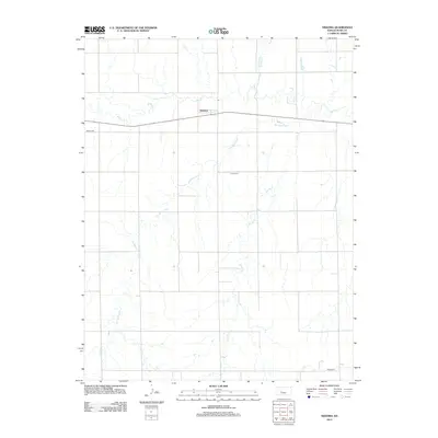
2012 Map of Nekoma
USGS Topo · Published 2012About this map
Nekoma serves as the central settlement in this portion of Rush County, situated along the path of Highway 96. The landscape is defined by the dendritic drainage patterns of Walnut Cr and its various tributaries, which carve through the plains. Local history and genealogy are anchored by several dispersed burial grounds, including Abbey Cem to the west, Union Cem near the center, and Hope Cem in the southeastern corner. The intricate hydrology of the region is further detailed by the courses of Old Maids Fork, Sandy Cr, and Otter Cr, reflecting a rural environment where water sources and high-ground roads dictated the placement of small communities and family sites.
Find a feature on this map
9 named features on this map. Tap any name to fly to it.
Don’t see what you’re looking for? This feature index may not catch every label — zoom into the map to look around manually.
Map Details
Editions of this 2012 Nekoma Map
This is the sole edition of this map. No revisions or reprints were ever made.
Other maps of this area

1889 · Larned
USGS Topo · 1:125,000

1891 · Larned
USGS Topo · 1:125,000

1892 · Ness
USGS Topo · 1:125,000

1893 · Ellis
USGS Topo · 1:125,000

1894 · Ness
USGS Topo · 1:125,000

1896 · Hays
USGS Topo · 1:125,000

1955 · Great Bend
USGS Topo · 1:250,000

1957 · Great Bend
USGS Topo · 1:250,000

1958 · Great Bend
USGS Topo · 1:250,000

1965 · Mc Cracken
USGS Topo · 1:24,000