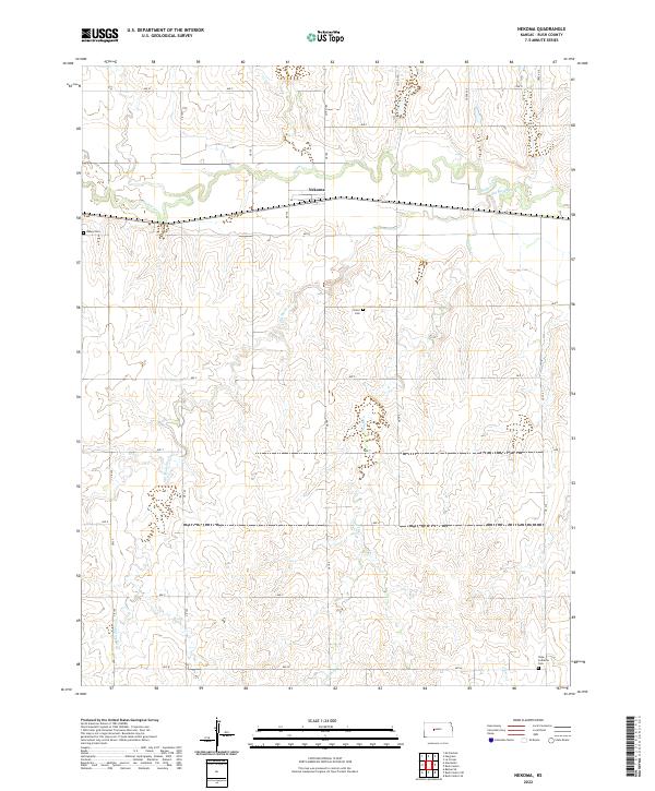
2022 Map of Nekoma
USGS Topo · Published 2022About this map
Nekoma is the primary settlement on this Rush County landscape, where the prairie topography is defined by the incision of Walnut Cr and its various tributaries. The drainage patterns of Old Maids Fork and Sandy Cr carve the undulating terrain, creating a network of ridges and draws that dictates the rectilinear grid of local roads like CR 175 and Ave Q. This map reveals a community structured around its watercourses and rural burial grounds, including the Union Cem situated on high ground and the Abbey Cem to the west. Further south, the Hope Lutheran Cem near Otter Cr serves as a point of reference for genealogists tracking local families in this agricultural region. The grid of section lines and county roads underscores the enduring township-and-range surveying system that has organized this part of Kansas since its initial settlement.
Find a feature on this map
33 named features on this map. Tap any name to fly to it.
Don’t see what you’re looking for? This feature index may not catch every label — zoom into the map to look around manually.
Map Details
Editions of this 2022 Nekoma Map
This is the sole edition of this map. No revisions or reprints were ever made.
Other maps of this area

1889 · Larned
USGS Topo · 1:125,000

1891 · Larned
USGS Topo · 1:125,000

1892 · Ness
USGS Topo · 1:125,000

1893 · Ellis
USGS Topo · 1:125,000

1894 · Ness
USGS Topo · 1:125,000

1896 · Hays
USGS Topo · 1:125,000

1955 · Great Bend
USGS Topo · 1:250,000

1957 · Great Bend
USGS Topo · 1:250,000

1958 · Great Bend
USGS Topo · 1:250,000

1965 · Mc Cracken
USGS Topo · 1:24,000