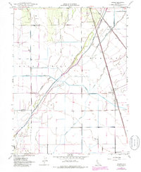
1948 Map of Nelson
USGS Topo · Published 1988About this map
Agricultural irrigation and rail transport define the landscape of this Central Valley region during the mid-20th century. The settlement of Nelson serves as a focal point, situated at the junction of Nelson Road and the Southern Pacific railroad line. To the north, the smaller rail stop at Esquon is positioned near the Sacramento Northern tracks, highlighting the era's reliance on twin rail corridors for moving crops and goods.
Find a feature on this map
17 named features on this map. Tap any name to fly to it.
Don’t see what you’re looking for? This feature index may not catch every label — zoom into the map to look around manually.
Map Details
Editions of this 1948 Nelson Map
4 editions found
Other maps of this area

1888 · Marysville
USGS Topo · 1:125,000

1891 · Chico
USGS Topo · 1:125,000

1891 · Marysville
USGS Topo · 1:125,000

1893 · Chico
USGS Topo · 1:125,000

1894 · Marysville
USGS Topo · 1:125,000

1895 · Marysville
USGS Topo · 1:125,000

1895 · Chico
USGS Topo · 1:125,000

1911 · Landlow
USGS Topo · 1:31,680

1912 · Dry Creek
USGS Topo · 1:31,680

1912 · Durham
USGS Topo · 1:31,680