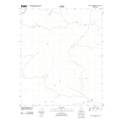
2010 Map of Nelson Canyon East
USGS Topo · Published 2010About this map
Lincoln County Livestock Company anchors the southeastern corner of this arid landscape, reflecting the enduring ranching economy of this portion of Lincoln County. The map is defined by a complex network of dry drainages and steep-walled canyons, including the significant Nelson Canyon and the winding course of Blackwater Canyon. These natural features dictated the placement of early settlements and outposts, such as the Old Pruit Ranch and Cooper Ranch, which appear near their respective watercourses. The topography transitions from the high ridges above Deadman Canyon to the broad drainage of Big Draw, illustrating the stark and functional geography required for livestock operations in the Southwest. Other notable features include the southern reaches of Tecolote Canyon and Coyote Canyon, providing a clear record of the ranching landmarks and natural terrain as they existed in the early 21st century.
Find a feature on this map
10 named features on this map. Tap any name to fly to it.
Don’t see what you’re looking for? This feature index may not catch every label — zoom into the map to look around manually.
Map Details
Editions of this 2010 Nelson Canyon East Map
This is the sole edition of this map. No revisions or reprints were ever made.
Other maps of this area

1936 · Arabela
USGS Topo · 1:48,000

1942 · Arabela
USGS Topo · 1:62,500

1955 · Roswell
USGS Topo · 1:250,000

1958 · Roswell
USGS Topo · 1:250,000

1961 · Tinnie
USGS Topo · 1:62,500

1962 · Roswell
USGS Topo · 1:250,000

1962 · Horseshoe Bend
USGS Topo · 1:62,500
1967 · Elsie Canyon
USGS Topo · 1:24,000

1979 · Roswell
USGS Topo · 1:100,000
1979 · Salt Creek
USGS Topo · 1:100,000