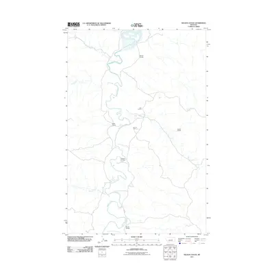
2011 Map of Nelson Coulee
USGS Topo · Published 2011About this map
The Musselshell River meanders through this portion of Petroleum County, carving a deep path through a landscape defined by sharp coulees and remote drainage systems. The river is joined by several significant tributaries, including Lodgepole Creek, Dovetail Creek, and Drag Creek, illustrating the complex hydrology of this high plains environment. Human activity is sparse, marked primarily by the Matovich Ranch and the isolated Coon Cemetery located near the northern reaches of Lodgepole Creek.
Find a feature on this map
15 named features on this map. Tap any name to fly to it.
Don’t see what you’re looking for? This feature index may not catch every label — zoom into the map to look around manually.
Map Details
Editions of this 2011 Nelson Coulee Map
This is the sole edition of this map. No revisions or reprints were ever made.
Other maps of this area

1954 · Jordan
USGS Topo · 1:250,000

1954 · Lewistown
USGS Topo · 1:250,000

1956 · Jordan
USGS Topo · 1:250,000

1958 · Jordan
USGS Topo · 1:250,000

1959 · Lewistown
USGS Topo · 1:250,000

1964 · Jordan
USGS Topo · 1:250,000

1965 · Germaine Coulee East
USGS Topo · 1:24,000

1965 · Germaine Coulee West
USGS Topo · 1:24,000
1965 · Weingart Place
USGS Topo · 1:24,000

1967 · Nelson Coulee
USGS Topo · 1:24,000