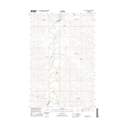
2017 Map of Nelson Coulee
USGS Topo · Published 2017About this map
The Musselshell River carves a winding path along the boundary of Petroleum and Garfield counties, defining the central axis of this landscape. The terrain is dominated by a complex network of dry washes and canyons, including its namesake Nelson Coulee, as well as Bratten Coulee and Gibbs Coulee. Human markers are sparse but significant for local history, notably the Coon Cem situated near the intersection of various township lines. To the north, the map shows the transition toward the shores of Fort Peck Lake, where the drainage of Alkali Cr meets the reservoir. Transportation follows the contours of the land via routes like Stage Rd and Dunn Ridge St, which navigate the high ground between the river and the various springs, such as School Section Spring.
Find a feature on this map
25 named features on this map. Tap any name to fly to it.
Don’t see what you’re looking for? This feature index may not catch every label — zoom into the map to look around manually.
Map Details
Editions of this 2017 Nelson Coulee Map
This is the sole edition of this map. No revisions or reprints were ever made.
Other maps of this area

1954 · Jordan
USGS Topo · 1:250,000

1954 · Lewistown
USGS Topo · 1:250,000

1956 · Jordan
USGS Topo · 1:250,000

1958 · Jordan
USGS Topo · 1:250,000

1959 · Lewistown
USGS Topo · 1:250,000

1964 · Jordan
USGS Topo · 1:250,000

1965 · Germaine Coulee East
USGS Topo · 1:24,000

1965 · Germaine Coulee West
USGS Topo · 1:24,000
1965 · Weingart Place
USGS Topo · 1:24,000

1967 · Nelson Coulee
USGS Topo · 1:24,000