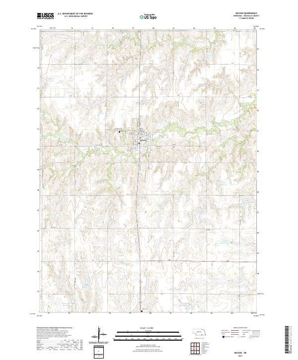
2021 Map of Nelson
USGS Topo · Published 2021About this map
Nelson serves as the central hub of this South Central Nebraska landscape, anchored by the Nuckolls County Courthouse and a street grid that includes W Gourlay Ave and Mt Clare Rd. The surrounding terrain is defined by a dense network of agricultural water management, evidenced by numerous named impoundments such as Wehrman Reservoir, Gebhards Reservoir, and Schiermeyer Reservoir. These water sources are fed by local drainages including Oxbow Cr, Elk Cr, and Spring Cr.
Find a feature on this map
37 named features on this map. Tap any name to fly to it.
Don’t see what you’re looking for? This feature index may not catch every label — zoom into the map to look around manually.
Map Details
Editions of this 2021 Nelson Map
This is the sole edition of this map. No revisions or reprints were ever made.
Other maps of this area

1898 · Superior
USGS Topo · 1:125,000

1898 · Hebron
USGS Topo · 1:125,000

1955 · Lincoln
USGS Topo · 1:250,000

1955 · Grand Island
USGS Topo · 1:250,000

1957 · Lincoln
USGS Topo · 1:250,000

1957 · Grand Island
USGS Topo · 1:250,000

1958 · Grand Island
USGS Topo · 1:250,000

1958 · Lincoln
USGS Topo · 1:250,000

1960 · Edgar
USGS Topo · 1:24,000
1960 · Fairfield SE
USGS Topo · 1:24,000