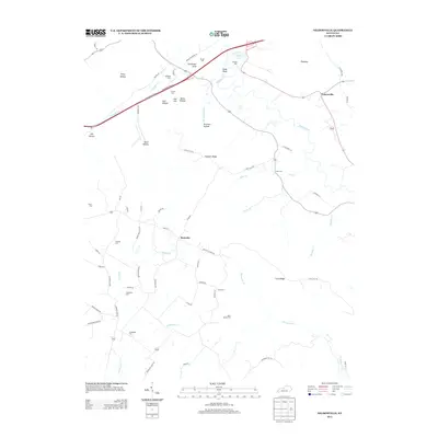
2013 Map of Nelsonville
USGS Topo · Published 2013About this map
Rolling Fork meanders through the heart of this landscape, carving out a series of significant hollows and ridges that define the rural character of Larue County. The settlement of Nelsonville serves as a primary reference point in the northeast, while Roanoke anchors the central valley near Middle Cr. The distribution of family-named burial grounds across the terrain, such as Bledsoe Cem, Vernon Cem, and Neff Cem, reflects a deeply rooted community structure tied to specific landholdings. Notable elevations like Potmesser Knob and Cedar Knob rise above the drainage basins of Broadhead Run and Edlin Cr. This modern survey details the intricate network of local roads, from Spencer School Rd to Brown Cemetery Ln, that continue to connect these ancestral sites and small farmsteads.
Find a feature on this map
74 named features on this map. Tap any name to fly to it.
Don’t see what you’re looking for? This feature index may not catch every label — zoom into the map to look around manually.
Map Details
Editions of this 2013 Nelsonville Map
This is the sole edition of this map. No revisions or reprints were ever made.
Other maps of this area

1935 · Elizabethtown
USGS Topo · 1:48,000

1936 · Vine Grove
USGS Topo · 1:62,500

1938 · Elizabethtown
USGS Topo · 1:62,500

1943 · Vine Grove
USGS Topo · 1:62,500

1946 · Colesburg
USGS Topo · 1:24,000

1946 · Vine Grove
USGS Topo · 1:62,500

1949 · Cravens
USGS Topo · 1:24,000

1949 · Tonieville
USGS Topo · 1:24,000

1949 · Elizabethtown
USGS Topo · 1:24,000

1949 · Shepherdsville
USGS Topo · 1:62,500