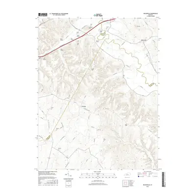
2016 Map of Nelsonville
USGS Topo · Published 2016About this map
Roanoke and Nelsonville anchor this map of the Kentucky interior, where the boundaries of Hardin, Nelson, and Larue counties meet along the Rolling Fork river. The landscape is defined by its deep connectivity to family history, evidenced by a high density of small burial grounds including Bledsoe Cem, Vernon Cem, and Harris Cem. The terrain is characterized by a series of prominent ridges and knobs, such as Farmers Ridge, Potmesser Knob, and Cedar Knob, which separate the various hollows that feed into the river system.
Find a feature on this map
73 named features on this map. Tap any name to fly to it.
Don’t see what you’re looking for? This feature index may not catch every label — zoom into the map to look around manually.
Map Details
Editions of this 2016 Nelsonville Map
This is the sole edition of this map. No revisions or reprints were ever made.
Other maps of this area

1935 · Elizabethtown
USGS Topo · 1:48,000

1936 · Vine Grove
USGS Topo · 1:62,500

1938 · Elizabethtown
USGS Topo · 1:62,500

1943 · Vine Grove
USGS Topo · 1:62,500

1946 · Colesburg
USGS Topo · 1:24,000

1946 · Vine Grove
USGS Topo · 1:62,500

1949 · Cravens
USGS Topo · 1:24,000

1949 · Tonieville
USGS Topo · 1:24,000

1949 · Elizabethtown
USGS Topo · 1:24,000

1949 · Shepherdsville
USGS Topo · 1:62,500