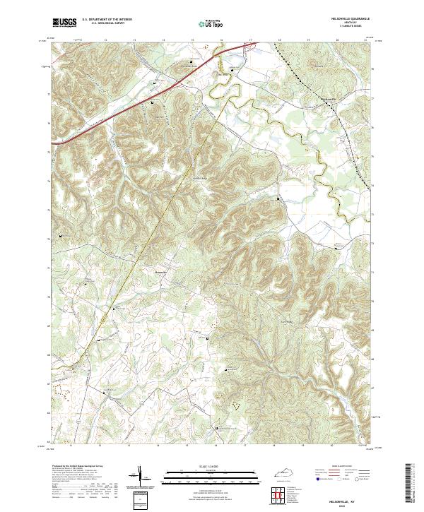
2022 Map of Nelsonville
USGS Topo · Published 2022About this map
Nelsonville and Roanoke sit at the center of this rural landscape where the Rolling Fork river winds through the terrain of Kentucky. The area is defined by a high concentration of family and community burial grounds, illustrating a deep history of local settlement and genealogical continuity. Locations like the Union Church Cem, Thomas Family Cem, and Middle Creek Cem are scattered across the ridges and hollows, often near old farmsteads or small hamlets. Significant physical landmarks including Potmesser Knob and Pinnacle rise above the drainage basins of Younger Cr and Thompson Cr. The modern Blue Grass Pkwy cuts across the northern section, contrasting with the network of older local routes such as Spencer School Rd and Valley Creek Rd that follow the natural contours of the land.
Find a feature on this map
80 named features on this map. Tap any name to fly to it.
Don’t see what you’re looking for? This feature index may not catch every label — zoom into the map to look around manually.
Map Details
Editions of this 2022 Nelsonville Map
This is the sole edition of this map. No revisions or reprints were ever made.
Other maps of this area

1935 · Elizabethtown
USGS Topo · 1:48,000

1936 · Vine Grove
USGS Topo · 1:62,500

1938 · Elizabethtown
USGS Topo · 1:62,500

1943 · Vine Grove
USGS Topo · 1:62,500

1946 · Colesburg
USGS Topo · 1:24,000

1946 · Vine Grove
USGS Topo · 1:62,500

1949 · Cravens
USGS Topo · 1:24,000

1949 · Tonieville
USGS Topo · 1:24,000

1949 · Elizabethtown
USGS Topo · 1:24,000

1949 · Shepherdsville
USGS Topo · 1:62,500