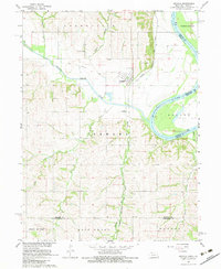
1966 Map of Nemaha
USGS Topo · Published 1983About this map
Little Nemaha River and Missouri River converge in this mid-1960s survey of southeastern Nebraska, marking a landscape defined by waterway confluences and early transportation corridors. The village of Nemaha sits at the junction of the Chicago Burlington and Quincy railroad and an Old Railroad Grade, illustrating the shifting patterns of rail transport in the Missouri River Basin. Genealogists can locate family landmarks including Maple Grove Sch, Nemaha Cem, and Pennwell Cem, providing specific anchors for local history research. The topography transitions from the low-lying Morgan Island to the bluffs of Benton and Brown Ville, where several Quarries and a Quarry signify the local extractive industry along the river bluffs near Whisky Run and Jarvis Creek.
Find a feature on this map
26 named features on this map. Tap any name to fly to it.
Don’t see what you’re looking for? This feature index may not catch every label — zoom into the map to look around manually.
Map Details
Editions of this 1966 Nemaha Map
2 editions found
Other maps of this area

1915 · Falls City
USGS Topo · 1:62,500

1915 · Nemaha
USGS Topo · 1:62,500

1915 · Howe
USGS Topo · 1:62,500

1916 · Humboldt
USGS Topo · 1:62,500

1939 · Nemaha
USGS Topo · 1:62,500

1949 · Nemaha
USGS Topo · 1:62,500

1955 · Nebraska City
USGS Topo · 1:250,000

1957 · Nebraska City
USGS Topo · 1:250,000

1958 · Nebraska City
USGS Topo · 1:250,000
1965 · Dawson
USGS Topo · 1:24,000