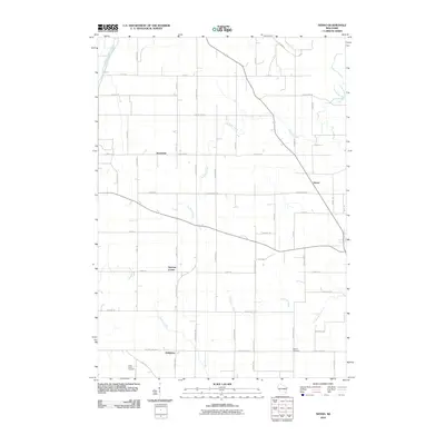
2010 Map of Nenno
USGS Topo · Published 2010About this map
Agricultural lands and rural crossroads define this corner of Washington County, where the East Branch Rock River flows through the northern reaches. The settlement pattern is characterized by small clusters of activity at junctions like Hochheim, Nenno, and Herman Center. These hamlets are connected by a rigid grid of local thoroughfares such as Zion Church Rd and Nenno Rd, reflecting the long-standing land divisions of the region.
Find a feature on this map
31 named features on this map. Tap any name to fly to it.
Don’t see what you’re looking for? This feature index may not catch every label — zoom into the map to look around manually.
Map Details
Editions of this 2010 Nenno Map
This is the sole edition of this map. No revisions or reprints were ever made.
Other maps of this area

1904 · Hartford
USGS Topo · 1:62,500

1955 · Waupun
USGS Topo · 1:62,500

1955 · Campbellsport
USGS Topo · 1:62,500

1955 · Horicon
USGS Topo · 1:62,500

1957 · Madison
USGS Topo · 1:250,000

1959 · Hartford
USGS Topo · 1:62,500

1959 · Nenno
USGS Topo · 1:24,000

1959 · Allenton
USGS Topo · 1:24,000
1959 · Hartford East
USGS Topo · 1:24,000
1959 · Hartford West
USGS Topo · 1:24,000