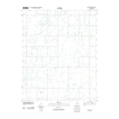
2010 Map of Neodesha
USGS Topo · Published 2010About this map
Willow Cemetery sits in the western portion of this landscape, marking a quiet point of history in northern Wagoner County. The terrain is defined by a dense network of country roads, such as N 4220 Rd and E 0670 Rd, which partition the land into a grid reflecting the area's agricultural and rural development. Waterways including the meandering Bull Creek and Flat Rock Creek drain the countryside, while the prominent Osage Mound stands as a distinct topographical landmark in the south. The distribution of small ponds and the intersection of roads like S 4250 Rd suggest a landscape largely dedicated to ranching and farming during the early 21st century.
Find a feature on this map
26 named features on this map. Tap any name to fly to it.
Don’t see what you’re looking for? This feature index may not catch every label — zoom into the map to look around manually.
Map Details
Editions of this 2010 Neodesha Map
This is the sole edition of this map. No revisions or reprints were ever made.
Other maps of this area

1896 · Okmulgee
USGS Topo · 1:125,000

1896 · Pryor
USGS Topo · 1:125,000

1900 · Okmulgee
USGS Topo · 1:125,000

1901 · Muscogee
USGS Topo · 1:125,000

1901 · Claremore
USGS Topo · 1:125,000

1901 · Pryor
USGS Topo · 1:125,000

1905 · Muscogee
USGS Topo · 1:125,000

1914 · Claremore
USGS Topo · 1:125,000

1916 · Claremore
USGS Topo · 1:125,000

1946 · Fort Smith
USGS Topo · 1:250,000