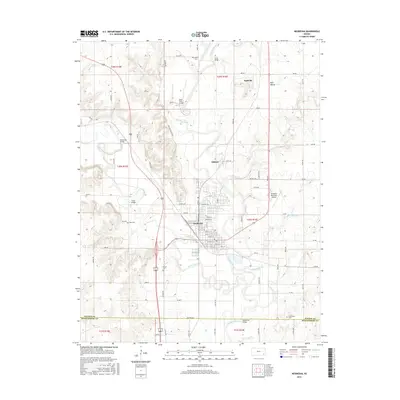
2016 Map of Neodesha
USGS Topo · Published 2016About this map
The confluence of the Verdigris River and Fall River anchor this Southeast Kansas landscape, centering on the city of Neodesha. This mid-2010s survey reveals a territory where early industry and river crossings have left a distinct topographical mark. To the north, the small community of Buffville sits near the prominent Buff Mound, while several historic crossings like the Verdi Bridge, Whiteside Bridge, and Bulls Ford Bridge illustrate the long-standing importance of river navigation and transport in Wilson County. Genealogists can locate several burial sites throughout the rural sections, including Hatler Cem, Ross Cem, and Varner Cem near the city, as well as Grandview Cem along the southern border. The transition from agricultural grid roads like Ottawa Rd and Newton Rd to the more structured streets of the city center, such as Granby Ave and Tank Ave, demonstrates the local development patterns of the region.
Find a feature on this map
85 named features on this map. Tap any name to fly to it.
Don’t see what you’re looking for? This feature index may not catch every label — zoom into the map to look around manually.
Map Details
Editions of this 2016 Neodesha Map
This is the sole edition of this map. No revisions or reprints were ever made.
Other maps of this area

1886 · Fredonia
USGS Topo · 1:125,000

1886 · Independence
USGS Topo · 1:125,000

1894 · Fredonia
USGS Topo · 1:125,000

1894 · Independence
USGS Topo · 1:125,000

1905 · Independence
USGS Topo · 1:125,000

1938 · Fredonia
USGS Topo · 1:62,500

1938 · Altoona
USGS Topo · 1:62,500

1939 · Altoona
USGS Topo · 1:48,000

1939 · Fredonia
USGS Topo · 1:48,000

1942 · Fredonia
USGS Topo · 1:62,500