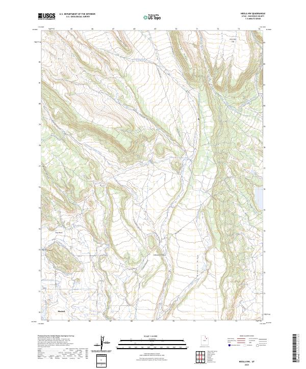
2023 Map of Neola NW
USGS Topo · Published 2023About this map
Bluebell anchors the southern landscape of this northern Utah survey, where the arid high country meets a sophisticated network of irrigation infrastructure. The territory is defined by the managed movement of water through the Yellowstone Feeder Canal and Yellowstone Extension Canal, which cut across the desert terrain to support local agriculture. Prominent landforms such as Pine-Nut Ridge, Tower Ridge, and the expansive John Starr Flat illustrate the varied elevations of the Uinta Basin's edge. Smaller waterways like Timothy Creek and Spring Branch Creek thread through the northern ridges, while the Cottonwood Wash and Big Sand Wash reveal the erosive forces shaping the basins. In the more settled areas near Bluebell, a grid of rural roads including HWY 6610 N and Claybasin Pond Rd provides access to local ditches and laterals, including the North Ditch and Bluebell Lateral, showing how modern water management has shaped the geography of Duchesne County.
Find a feature on this map
36 named features on this map. Tap any name to fly to it.
Don’t see what you’re looking for? This feature index may not catch every label — zoom into the map to look around manually.
Map Details
Editions of this 2023 Neola NW Map
This is the sole edition of this map. No revisions or reprints were ever made.
Other maps of this area

1885 · Uinta
USGS Topo · 1:250,000

1905 · Gilbert Peak
USGS Topo · 1:125,000

1906 · Gilbert Peak
USGS Topo · 1:125,000

1939 · Duchesne
USGS Topo · 1:125,000

1954 · Salt Lake City
USGS Topo · 1:250,000

1958 · Salt Lake City
USGS Topo · 1:250,000

1960 · Salt Lake City
USGS Topo · 1:250,000
1965 · Bluebell
USGS Topo · 1:24,000
1965 · Neola
USGS Topo · 1:24,000
1965 · Pole Creek Cave
USGS Topo · 1:24,000