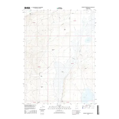
2017 Map of Neponset Reservoir NW
USGS Topo · Published 2017About this map
Neponset Reservoir and the expansive Big Meadow dominate the low-lying drainage of this corner of Rich County. This landscape is defined by its complex water management system, where the naturally alkaline Saleratus Creek and Dry Cr are augmented by human-made features like the Co-Op Ditch. The network of rural routes, including Home Ranch Rd and Main Ranch Way, underscores the area's agricultural and ranching heritage.
Find a feature on this map
30 named features on this map. Tap any name to fly to it.
Don’t see what you’re looking for? This feature index may not catch every label — zoom into the map to look around manually.
Map Details
Editions of this 2017 Neponset Reservoir NW Map
This is the sole edition of this map. No revisions or reprints were ever made.
Other maps of this area

1912 · Randolph
USGS Topo · 1:125,000

1954 · Ogden
USGS Topo · 1:250,000

1958 · Ogden
USGS Topo · 1:250,000

1960 · Ogden
USGS Topo · 1:250,000

1968 · Woodruff
USGS Topo · 1:24,000

1968 · Mc Kay Hollow
USGS Topo · 1:24,000

1968 · Neponset Reservoir NE
USGS Topo · 1:24,000

1968 · Meachum Ridge
USGS Topo · 1:24,000

1968 · Peck Canyon
USGS Topo · 1:24,000
1968 · Woodruff Narrows
USGS Topo · 1:24,000