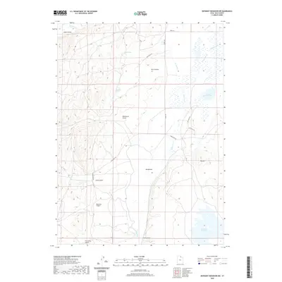
2020 Map of Neponset Reservoir NW
USGS Topo · Published 2020About this map
Neponset Reservoir and the surrounding high-elevation drainage basins of Rich County define this landscape. The map details an intricate network of seasonal and perennial water features, including the Saleratus Creek, Woodruff Cr, and the human-engineered Co-Op Ditch. This area is characterized by significant topographic depressions and canyons such as Home Canyon, Meachum Canyon, and Five Spring Canyon, which channel runoff toward the expansive Big Meadow.
Find a feature on this map
24 named features on this map. Tap any name to fly to it.
Don’t see what you’re looking for? This feature index may not catch every label — zoom into the map to look around manually.
Map Details
Editions of this 2020 Neponset Reservoir NW Map
This is the sole edition of this map. No revisions or reprints were ever made.
Other maps of this area

1912 · Randolph
USGS Topo · 1:125,000

1954 · Ogden
USGS Topo · 1:250,000

1958 · Ogden
USGS Topo · 1:250,000

1960 · Ogden
USGS Topo · 1:250,000

1968 · Woodruff
USGS Topo · 1:24,000

1968 · Mc Kay Hollow
USGS Topo · 1:24,000

1968 · Neponset Reservoir NE
USGS Topo · 1:24,000

1968 · Meachum Ridge
USGS Topo · 1:24,000

1968 · Peck Canyon
USGS Topo · 1:24,000
1968 · Woodruff Narrows
USGS Topo · 1:24,000