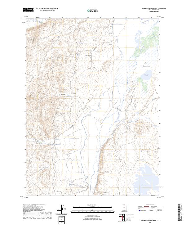
2023 Map of Neponset Reservoir NW
USGS Topo · Published 2023About this map
Saleratus Creek meanders through the high basins of Rich County, Utah, providing a central drainage for a landscape defined by seasonal water and ranching infrastructure. The hydrologic network is a mix of natural springs like Eagle Springs and Halfway Spring and managed water systems including the Co-Op Ditch, which reflects the historical cooperation required for agriculture in this arid environment. Significant grazing and transit lands are identified by large named meadows and depressions, most notably Big Meadow and the expansive Wheatgrass Hollow.
Find a feature on this map
22 named features on this map. Tap any name to fly to it.
Don’t see what you’re looking for? This feature index may not catch every label — zoom into the map to look around manually.
Map Details
Editions of this 2023 Neponset Reservoir NW Map
This is the sole edition of this map. No revisions or reprints were ever made.
Other maps of this area

1912 · Randolph
USGS Topo · 1:125,000

1954 · Ogden
USGS Topo · 1:250,000

1958 · Ogden
USGS Topo · 1:250,000

1960 · Ogden
USGS Topo · 1:250,000

1968 · Woodruff
USGS Topo · 1:24,000

1968 · Mc Kay Hollow
USGS Topo · 1:24,000

1968 · Neponset Reservoir NE
USGS Topo · 1:24,000

1968 · Meachum Ridge
USGS Topo · 1:24,000

1968 · Peck Canyon
USGS Topo · 1:24,000
1968 · Woodruff Narrows
USGS Topo · 1:24,000