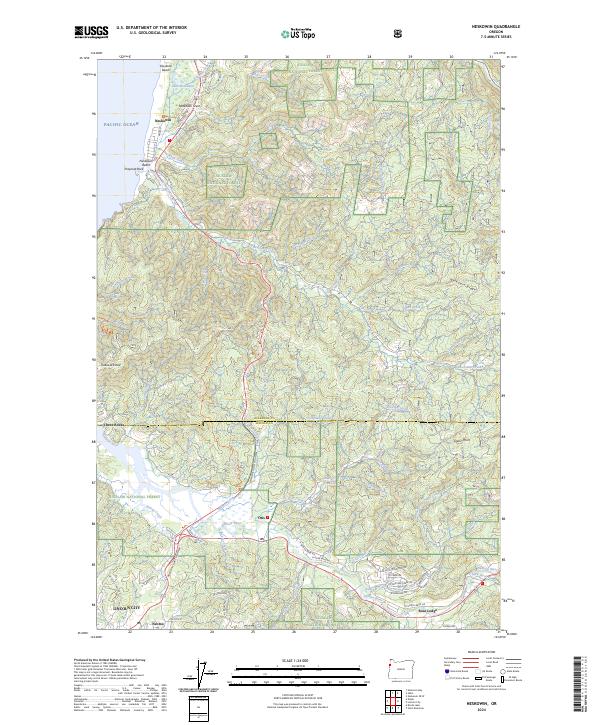
2024 Map of Neskowin
USGS Topo · Published 2024About this map
Neskowin sits along the Pacific coastline where the Salmon River meets the sea, serving as a primary point of interest in this coastal landscape. The terrain is defined by dramatic geography such as Cascade Head and Neskowin Ridge, which separate the various drainages of Neskowin Creek and Sutton Creek. To the south, the settlement of Otis is positioned near the confluence of the Salmon River and several smaller tributaries like Deer Creek, illustrating the inland settlement pattern along the river valley.
Find a feature on this map
81 named features on this map. Tap any name to fly to it.
Don’t see what you’re looking for? This feature index may not catch every label — zoom into the map to look around manually.
Map Details
Editions of this 2024 Neskowin Map
This is the sole edition of this map. No revisions or reprints were ever made.
Other maps of this area

1941 · Nestucca Bay
USGS Topo · 1:62,500

1941 · Cape Foulweather
USGS Topo · 1:62,500

1942 · Euchre Mtn
USGS Topo · 1:62,500

1942 · Nestucca Bay
USGS Topo · 1:62,500

1943 · Euchre Mtn
USGS Topo · 1:62,500

1944 · Cape Foulweather
USGS Topo · 1:62,500

1948 · Vancouver
USGS Topo · 1:250,000

1950 · Vancouver
USGS Topo · 1:250,000

1950 · Vancouver
USGS Topo · 1:250,000

1953 · Salem
USGS Topo · 1:250,000