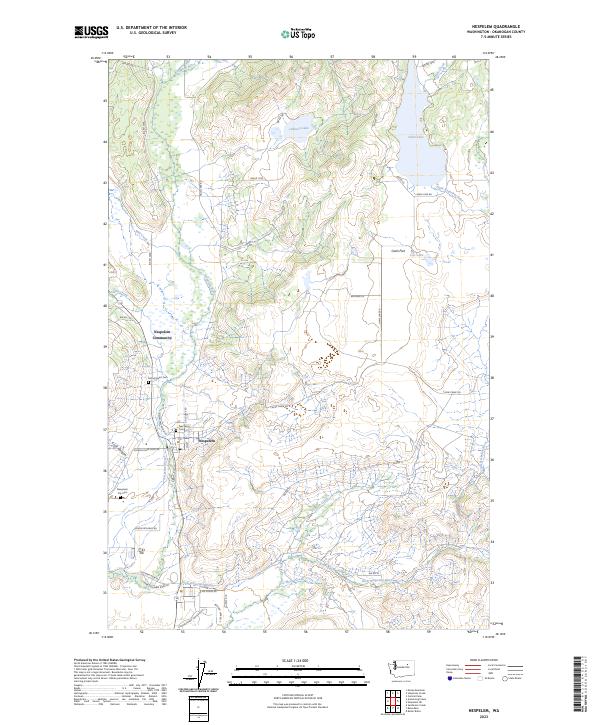
2023 Map of Nespelem
USGS Topo · Published 2023About this map
Nespelem and the Nespelem Community occupy the lower valley where the Nespelem River descends toward the Columbia basin. This area on the Colville Indian Reservation is marked by significant cultural landmarks, including the Nez Perce Cem, Sacred Heart Cem, and Nespelem City Cem. The landscape transitions from the river bottoms to the higher elevation waters of Owhi Lake and Johnson Lake in the north. Settlement patterns follow the water, with the Little Nespelem River and Peewen Creek cutting through the terrain. Evidence of local family history and land use is preserved in the naming of rural routes such as Joe Moses Rd and Charlie Williams Rd, while the broad expanse of Owhi Flat suggests the agricultural and pastoral character of the upland regions.
Find a feature on this map
49 named features on this map. Tap any name to fly to it.
Don’t see what you’re looking for? This feature index may not catch every label — zoom into the map to look around manually.
Map Details
Editions of this 2023 Nespelem Map
This is the sole edition of this map. No revisions or reprints were ever made.
Other maps of this area

1950 · Nespelem
USGS Topo · 1:62,500

1950 · Alameda Flat
USGS Topo · 1:62,500

1952 · Alameda Flat
USGS Topo · 1:62,500

1952 · Disautel
USGS Topo · 1:62,500

1953 · Bald Knob
USGS Topo · 1:62,500

1954 · Okanogan
USGS Topo · 1:250,000

1958 · Okanogan
USGS Topo · 1:250,000
1983 · Omak
USGS Topo · 1:100,000

1984 · Nespelem
USGS Topo · 1:100,000

1986 · Central Peak
USGS Topo · 1:24,000