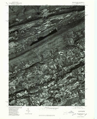
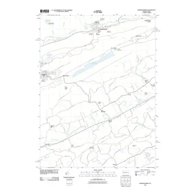
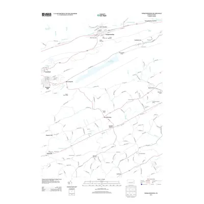
1976 Map of Nesquehoning
USGS Topo · Published 1979About this map
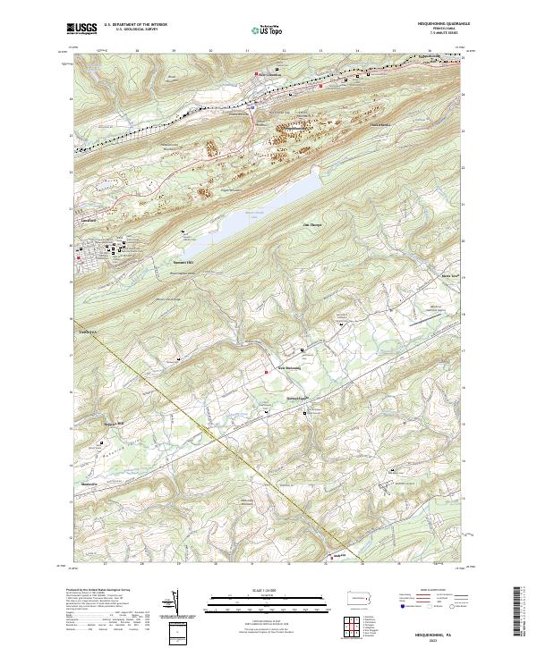
Jim Thorpe and the anthracite coal region appear here in the mid-1970s, as seen through a detailed orthophotoquad. The landscape is dominated by the dramatic geological formations of the Pisgah Mountain and Mauch Chunk Ridge, which hem in the industrial settlements of Lansford and Summit Hill. The photographic nature of this survey reveals the sharp contrast between the scarred, industrial zones on the ridges and the organized agricultural plots of the Mahoning Valley to the south.
Find a feature on this map
10 named features on this map. Tap any name to fly to it.
Don’t see what you’re looking for? This feature index may not catch every label — zoom into the map to look around manually.
Map Details
Editions of this 1976 Nesquehoning Map
This is the sole edition of this map. No revisions or reprints were ever made.
Historical Maps of Tamaqua Through Time
9 maps found
1948 Nesquehoning
Carbon County, PA
1950 Nesquehoning
Carbon County, PA
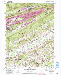
1976 Nesquehoning
Carbon County, PA
1997 Nesquehoning
Carbon County, PA
2010 Nesquehoning
Carbon County, PA
2013 Nesquehoning
Carbon County, PA
2016 Nesquehoning
Carbon County, PA
2019 Nesquehoning
Carbon County, PA
2023 Nesquehoning
Carbon County, PA