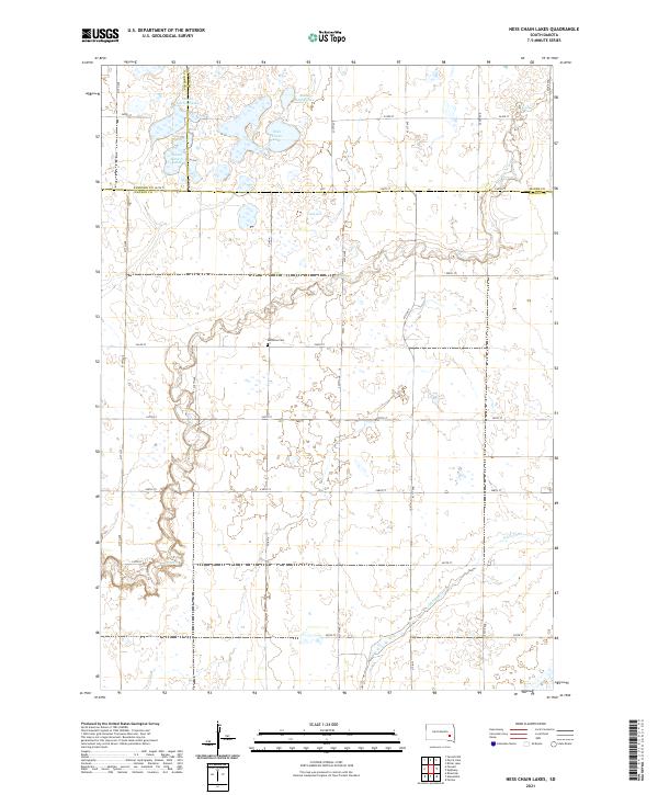
2021 Map of Ness Chain Lakes
USGS Topo · Published 2021About this map
Ness Chain Lake and its surrounding wetlands form the center of this prairie landscape at the junction of Sanborn, Miner, and Hanson counties. The terrain is defined by a dense network of glacial lakes and marshy depressions, including Stone House Lake and the School Section Lakes. This area reflects the typical township-and-range development of the northern plains, where a rigid grid of gravel roads like 420th Ave and 247th St provides the only passage through a complex water system. For local historians, the centrally located Redstone Cem serves as a significant landmark of early settlement. The drainage patterns of Rock Creek and Johnson Creek provide rare topographic relief in an otherwise low-lying region dominated by Lake Leo and numerous unnamed potholes.
Find a feature on this map
34 named features on this map. Tap any name to fly to it.
Don’t see what you’re looking for? This feature index may not catch every label — zoom into the map to look around manually.
Map Details
Editions of this 2021 Ness Chain Lakes Map
This is the sole edition of this map. No revisions or reprints were ever made.
Other maps of this area

1899 · Alexandria
USGS Topo · 1:125,000

1955 · Sioux Falls
USGS Topo · 1:250,000

1957 · Alexandria
USGS Topo · 1:24,000

1957 · Farwell NW
USGS Topo · 1:24,000

1957 · Riverside
USGS Topo · 1:24,000

1957 · Farwell
USGS Topo · 1:24,000

1958 · Sioux Falls
USGS Topo · 1:250,000
1973 · Morris Lake
USGS Topo · 1:24,000

1973 · Ness Chain Lakes
USGS Topo · 1:24,000

1973 · Farmer
USGS Topo · 1:24,000