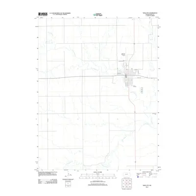
2012 Map of Ness City
USGS Topo · Published 2012About this map
Ness City serves as the central hub of this High Plains landscape, situated where the high prairie is dissected by the meandering courses of the N Fork Walnut Cr and S Fork Walnut Cr. The town's grid is anchored by W Main St and S Kansas Ave, featuring local landmarks such as the Ness County Fairgrounds and the Post Office. The surrounding geography is defined by a series of intermittent drainage systems, including Wild Horse Cr and Long Br, which illustrate the natural hydrology of the Kansas plains. For genealogists and local historians, the map identifies significant burial sites including Sacred Heart Cem on the south side of town and the more isolated Chenoworth Cem to the southeast. The presence of the Ness City Municipal Airport north of the city center highlights the region's modern infrastructure within a traditionally agricultural county.
Find a feature on this map
19 named features on this map. Tap any name to fly to it.
Don’t see what you’re looking for? This feature index may not catch every label — zoom into the map to look around manually.
Map Details
Editions of this 2012 Ness City Map
This is the sole edition of this map. No revisions or reprints were ever made.
Other maps of this area

1892 · Ness
USGS Topo · 1:125,000

1893 · Ellis
USGS Topo · 1:125,000

1894 · Ness
USGS Topo · 1:125,000

1955 · Great Bend
USGS Topo · 1:250,000

1955 · Scott City
USGS Topo · 1:250,000

1957 · Great Bend
USGS Topo · 1:250,000

1958 · Great Bend
USGS Topo · 1:250,000

1958 · Scott City
USGS Topo · 1:250,000

1966 · Ransom SE
USGS Topo · 1:24,000

1966 · Ness City
USGS Topo · 1:24,000