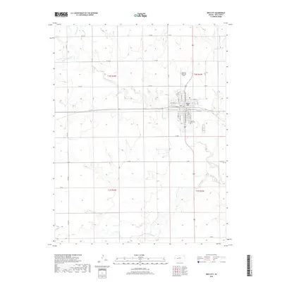
2018 Map of Ness City
USGS Topo · Published 2018About this map
Ness City stands as the central hub of this Ness County landscape, situated where the high plains are dissected by the drainage networks of the Walnut Creek system. The town's grid is anchored by thoroughfares like Walnut St and S Pennsylvania Ave, with the Ness City Municipal Airport located just to the north. This 2018 survey reveals a terrain defined by agricultural section lines and seasonal watercourses, including the N Fork Walnut Cr and S Fork Walnut Cr. Genealogists and local historians will find the location of Sacred Heart Cem on the southern edge of the city, while the more remote Chenoworth Cem lies to the east. The map provides a precise record of contemporary rural infrastructure, from the primary highways to the numbered section roads like W 140 Rd that lace the surrounding prairie.
Find a feature on this map
39 named features on this map. Tap any name to fly to it.
Don’t see what you’re looking for? This feature index may not catch every label — zoom into the map to look around manually.
Map Details
Editions of this 2018 Ness City Map
This is the sole edition of this map. No revisions or reprints were ever made.
Other maps of this area

1892 · Ness
USGS Topo · 1:125,000

1893 · Ellis
USGS Topo · 1:125,000

1894 · Ness
USGS Topo · 1:125,000

1955 · Great Bend
USGS Topo · 1:250,000

1955 · Scott City
USGS Topo · 1:250,000

1957 · Great Bend
USGS Topo · 1:250,000

1958 · Great Bend
USGS Topo · 1:250,000

1958 · Scott City
USGS Topo · 1:250,000

1966 · Ransom SE
USGS Topo · 1:24,000

1966 · Ness City
USGS Topo · 1:24,000