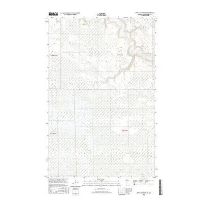
2016 Map of Nett Lake River SW
USGS Topo · Published 2016About this map
The Little Fork River carves a winding, meandering path through this Koochiching County landscape, defining the topography of the northeastern corner. Much of the surrounding terrain is dominated by extensive wetlands, characteristic of Northern Minnesota's hydrology, where the Rapid River flows eastward to join the larger drainage system. Human presence is limited to the periphery, marked primarily by the peripheral reach of River Rd in the north and the straight cut of Section 10 Rd near the river bends. This 2016 survey illustrates the persistent natural state of the region, showing how the intricate river oxbows and marshy lowlands dictate the placement of transportation routes and township boundaries like t65n r24w.
Find a feature on this map
8 named features on this map. Tap any name to fly to it.
Don’t see what you’re looking for? This feature index may not catch every label — zoom into the map to look around manually.
Map Details
Editions of this 2016 Nett Lake River SW Map
This is the sole edition of this map. No revisions or reprints were ever made.
Other maps of this area

1919 · M
USGS Topo · 1:62,500

1954 · Hibbing
USGS Topo · 1:250,000

1954 · International Falls
USGS Topo · 1:250,000

1957 · Hibbing
USGS Topo · 1:250,000

1957 · International Falls
USGS Topo · 1:250,000

1958 · International Falls
USGS Topo · 1:250,000

1958 · Hibbing
USGS Topo · 1:250,000

1964 · Hibbing
USGS Topo · 1:250,000

1970 · Johnson Landing SE
USGS Topo · 1:24,000

1970 · Nett Lake River SE
USGS Topo · 1:24,000