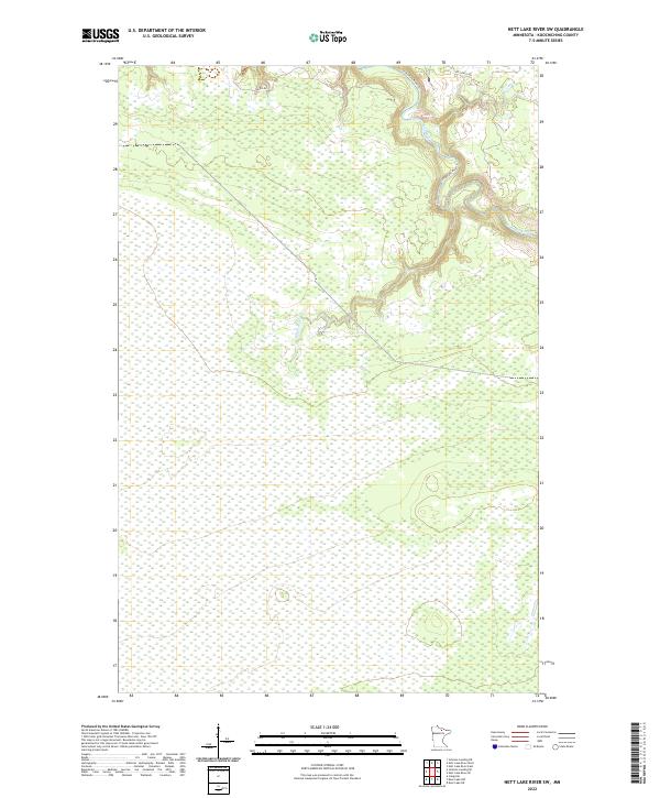
2022 Map of Nett Lake River SW
USGS Topo · Published 2022About this map
The Little Fork River meanders through the northeast corner of this Koochiching County landscape, defined by its complex northern river systems. Large swaths of the terrain are dominated by extensive wetlands, with the Rapid River cutting across the central sections. Human infrastructure is minimal, represented primarily by the winding River Rd and the geometric division of township boundaries like t65n-r24w and t64n r24w. This data, compiled from recent aerial imagery and hydrography datasets, illustrates the hydrologic character of the region before it flows toward the Canadian border. The presence of the Little Fork River Tri suggests the intricate drainage patterns that characterize this remote part of northern Minnesota.
Find a feature on this map
8 named features on this map. Tap any name to fly to it.
Don’t see what you’re looking for? This feature index may not catch every label — zoom into the map to look around manually.
Map Details
Editions of this 2022 Nett Lake River SW Map
This is the sole edition of this map. No revisions or reprints were ever made.
Other maps of this area

1919 · M
USGS Topo · 1:62,500

1954 · Hibbing
USGS Topo · 1:250,000

1954 · International Falls
USGS Topo · 1:250,000

1957 · Hibbing
USGS Topo · 1:250,000

1957 · International Falls
USGS Topo · 1:250,000

1958 · International Falls
USGS Topo · 1:250,000

1958 · Hibbing
USGS Topo · 1:250,000

1964 · Hibbing
USGS Topo · 1:250,000

1970 · Johnson Landing SE
USGS Topo · 1:24,000

1970 · Nett Lake River SE
USGS Topo · 1:24,000