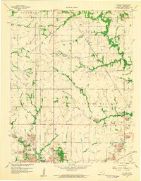
1958 Map of Neutral
USGS Topo · Published 1959About this map
Mining operations and industrial waste define the southern landscape of this Cherokee County quadrangle during the late 1950s. The southern border, particularly near Treece, is heavily marked by extensive Tailings and numerous Mine sites, illustrating the intensity of the Tri-State district's lead and zinc extraction. While the north remains largely agricultural around the community of Neutral, the land transformation is evident where Strip Mine excavations follow the path of Bitter Creek.
Find a feature on this map
25 named features on this map. Tap any name to fly to it.
Don’t see what you’re looking for? This feature index may not catch every label — zoom into the map to look around manually.
Map Details
Editions of this 1958 Neutral Map
3 editions found
Other maps of this area

1886 · Joplin
USGS Topo · 1:125,000

1894 · Joplin
USGS Topo · 1:125,000

1907 · Wyandotte
USGS Topo · 1:125,000

1909 · Wyandotte
USGS Topo · 1:125,000

1918 · Columbus
USGS Topo · 1:62,500

1947 · Joplin
USGS Topo · 1:250,000

1949 · Joplin
USGS Topo · 1:250,000

1954 · Tulsa
USGS Topo · 1:250,000

1954 · Joplin
USGS Topo · 1:250,000

1958 · Joplin
USGS Topo · 1:250,000