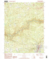
1995 Map of Nevada City
USGS Topo · Published 1995About this map
Nevada City serves as the focal point of this late-twentieth-century study, situated at the base of the Sierra foothills near the southern edge of the map. The landscape to the north and east is heavily defined by its gold mining history, clearly marked by extensive operations such as the Cherokee Diggings, Sebastopol Diggings, and North Columbia Diggings. These large-scale surface excavations, alongside various Gravel Pits and a Hydraulic Mine, demonstrate the lasting physical impact of hydraulic mining on the region's topography.
Find a feature on this map
64 named features on this map. Tap any name to fly to it.
Don’t see what you’re looking for? This feature index may not catch every label — zoom into the map to look around manually.
Map Details
Editions of this 1995 Nevada City Map
2 editions found
Other maps of this area

1888 · Smartsville
USGS Topo · 1:125,000

1891 · Colfax
USGS Topo · 1:125,000

1891 · Smartsville
USGS Topo · 1:125,000

1892 · Smartsville
USGS Topo · 1:125,000

1892 · Colfax
USGS Topo · 1:125,000

1894 · Colfax
USGS Topo · 1:125,000

1894 · Smartsville
USGS Topo · 1:125,000

1895 · Smartsville
USGS Topo · 1:125,000

1898 · Colfax
USGS Topo · 1:125,000

1900 · Colfax
USGS Topo · 1:125,000