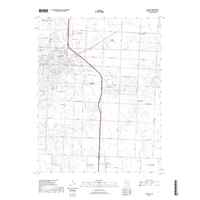
2017 Map of Nevada
USGS Topo · Published 2017About this map
Nevada serves as the focal point of this Vernon County landscape, showing a dense network of residential streets such as W Austin Blvd and E Atlantic St organized around the historic Cottey Coll. The town’s cemetery records are extensive, featuring the Nevada State Hospital Cem and Deepwood Cem, providing critical touchpoints for genealogical research. To the south and east, the terrain transitions into a patchwork of rural holdings and water management projects, including the Charles Vincent Reservoir and the John L Cunningham Reservoir.
Find a feature on this map
85 named features on this map. Tap any name to fly to it.
Don’t see what you’re looking for? This feature index may not catch every label — zoom into the map to look around manually.
Map Details
Editions of this 2017 Nevada Map
This is the sole edition of this map. No revisions or reprints were ever made.
Other maps of this area

1886 · Nevada
USGS Topo · 1:125,000

1894 · Nevada
USGS Topo · 1:125,000

1933 · Camp Clark
USGS Topo · 1:24,000

1938 · Metz
USGS Topo · 1:24,000

1938 · Horton
USGS Topo · 1:24,000

1939 · Metz
USGS Topo · 1:24,000

1939 · Horton
USGS Topo · 1:24,000

1939 · Dederick
USGS Topo · 1:24,000
1939 · Harwood
USGS Topo · 1:24,000

1939 · Moundville
USGS Topo · 1:24,000