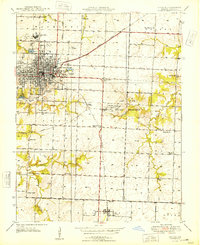
1948 Map of Nevada
USGS Topo · Published 1948About this map
Nevada serves as the focal point of this Vernon County landscape, where the convergence of the Missouri Pacific and Missouri Kansas Texas railroads once drove local commerce and transportation. The town's civic character is reflected in institutional landmarks like the State Insane Asylum and St Francis Convent, while its community life is marked by the Nevada Country Club and Izaak Walton Lake. To the east, the Camp Clark Military Reservation occupies a significant tract of land, underscoring the area's strategic utility during the mid-century era.
Find a feature on this map
44 named features on this map. Tap any name to fly to it.
Don’t see what you’re looking for? This feature index may not catch every label — zoom into the map to look around manually.
Map Details
Editions of this 1948 Nevada Map
This is the sole edition of this map. No revisions or reprints were ever made.
Other maps of this area

1886 · Nevada
USGS Topo · 1:125,000

1894 · Nevada
USGS Topo · 1:125,000

1933 · Camp Clark
USGS Topo · 1:24,000

1938 · Metz
USGS Topo · 1:24,000

1938 · Horton
USGS Topo · 1:24,000

1939 · Metz
USGS Topo · 1:24,000

1939 · Horton
USGS Topo · 1:24,000

1939 · Dederick
USGS Topo · 1:24,000
1939 · Harwood
USGS Topo · 1:24,000

1939 · Moundville
USGS Topo · 1:24,000