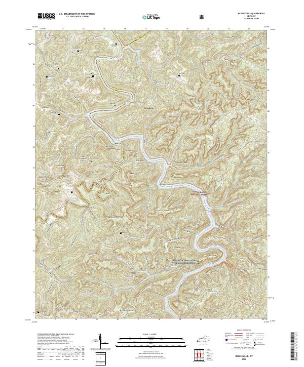
2022 Map of Nevelsville
USGS Topo · Published 2022About this map
Nevelsville and Morton Station anchor this map of the broken terrain where the Little South Fork meets the Big South Fork. The landscape is defined by the deep incisions of the Lake Cumberland headwaters, creating a complex series of high ridges and narrow hollows like Care Lick Hollow and Worley Hollow. Genealogists will find a high density of family-named landmarks and burial sites, including the Gran Young Graveyard, Gilson Keith Cem, and Jonesville Cem, which trace the early settlement patterns of this border region between Wayne, Pulaski, and McCreary counties. Much of the eastern portion is protected within the Daniel Boone National Forest, where the topography becomes particularly dramatic at Pinnacle Rock and Pound Cliff. This area's transition from a river-oriented economy to one of recreation and timber is evident in the network of trails like the Sheltowee Trace and various OHV routes.
Find a feature on this map
135 named features on this map. Tap any name to fly to it.
Don’t see what you’re looking for? This feature index may not catch every label — zoom into the map to look around manually.
Map Details
Editions of this 2022 Nevelsville Map
This is the sole edition of this map. No revisions or reprints were ever made.
Other maps of this area

1890 · Williamsburg
USGS Topo · 1:125,000

1894 · Williamsburg
USGS Topo · 1:125,000

1932 · Burnside
USGS Topo · 1:62,500

1934 · Barthell
USGS Topo · 1:62,500

1952 · Hail
USGS Topo · 1:24,000

1952 · Wiborg
USGS Topo · 1:24,000

1952 · Whitley City
USGS Topo · 1:24,000

1953 · Frazer
USGS Topo · 1:24,000

1954 · Coopersville
USGS Topo · 1:24,000

1954 · Burnside
USGS Topo · 1:24,000