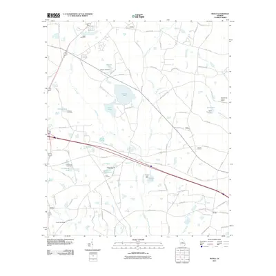
2011 Map of Nevils
USGS Topo · Published 2011About this map
Lotts Creek and its many tributaries, including Little Lotts Creek and Gum Branch, dominate this Bulloch County landscape south of Statesboro. The community of Nevils serves as the primary settlement, connected to the surrounding countryside by a dense network of family-named roads such as Tony Nevil Rd and Aden Lanier Rd. This region is defined by extensive agricultural water management, evidenced by numerous named impoundments including Kennedy Pond, Hickman Pond, and Delmus Rushing Lake. Genealogists will find several burial grounds across the quadrangle, notably Union Cemetery, Ephesus Cemetery, and the Brannen-Wilson Cemetery. The presence of the Southern Ag Aviation Airport highlights the ongoing importance of aerial application in this rural Georgia farming belt during the early twenty-first century.
Find a feature on this map
87 named features on this map. Tap any name to fly to it.
Don’t see what you’re looking for? This feature index may not catch every label — zoom into the map to look around manually.
Map Details
Editions of this 2011 Nevils Map
This is the sole edition of this map. No revisions or reprints were ever made.
Other maps of this area

1919 · Claxton
USGS Topo · 1:62,500

1920 · Pembroke
USGS Topo · 1:62,500

1920 · Statesboro
USGS Topo · 1:62,500

1921 · Brooklet
USGS Topo · 1:62,500

1943 · Brooklet
USGS Topo · 1:62,500

1943 · Statesboro
USGS Topo · 1:62,500

1944 · Claxton
USGS Topo · 1:62,500

1947 · Savannah
USGS Topo · 1:250,000

1948 · Savannah
USGS Topo · 1:250,000

1948 · Pembroke
USGS Topo · 1:62,500