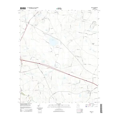
2014 Map of Nevils
USGS Topo · Published 2014About this map
Nevils serves as the primary community hub in this Bulloch County landscape, situated amid a complex network of agricultural lands and water features. The terrain is defined by numerous family-named bodies of water, such as Hickman Pond, Kennedy Pond, and Williams Pond, which feed into the winding courses of Lotts Cr and Little Lotts Cr. This 2014 survey documents the persistence of rural institutions and family history through its many burial grounds, including the Waters Cem, Kennedy Cem, and Brannen-Wilson Cem. The southern portion of the sheet shows the transition from Bulloch into Evans County, marked by the Scott Creek Bridge over Scott Cr. Modern infrastructure is represented by the Southern Ag Aviation Airport, reflecting the area's continued reliance on specialized aviation for its farming economy, while churches like Ephesus Church remain central landmarks for the surrounding rural population.
Find a feature on this map
115 named features on this map. Tap any name to fly to it.
Don’t see what you’re looking for? This feature index may not catch every label — zoom into the map to look around manually.
Map Details
Editions of this 2014 Nevils Map
This is the sole edition of this map. No revisions or reprints were ever made.
Other maps of this area

1919 · Claxton
USGS Topo · 1:62,500

1920 · Pembroke
USGS Topo · 1:62,500

1920 · Statesboro
USGS Topo · 1:62,500

1921 · Brooklet
USGS Topo · 1:62,500

1943 · Brooklet
USGS Topo · 1:62,500

1943 · Statesboro
USGS Topo · 1:62,500

1944 · Claxton
USGS Topo · 1:62,500

1947 · Savannah
USGS Topo · 1:250,000

1948 · Savannah
USGS Topo · 1:250,000

1948 · Pembroke
USGS Topo · 1:62,500