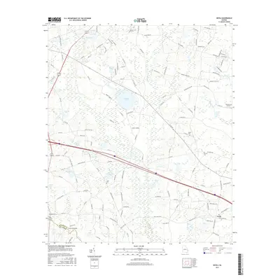
2017 Map of Nevils
USGS Topo · Published 2017About this map
Nevils serves as the focal point for this agrarian landscape in southern Georgia, situated near the boundary between Bulloch Co and Evans Co. The area is defined by a dense network of blackwater drainages including Lotts Creek, Little Lotts Creek, and Reedy Branch, which feed into numerous named impoundments such as Hickman Pond and Pelmus Rushing Lake. These water features, alongside Riggs Lake and Kennedy Pond, illustrate the historical reliance on local hydraulics for agriculture and milling in this corner of the coastal plain.
Find a feature on this map
127 named features on this map. Tap any name to fly to it.
Don’t see what you’re looking for? This feature index may not catch every label — zoom into the map to look around manually.
Map Details
Editions of this 2017 Nevils Map
This is the sole edition of this map. No revisions or reprints were ever made.
Other maps of this area

1919 · Claxton
USGS Topo · 1:62,500

1920 · Pembroke
USGS Topo · 1:62,500

1920 · Statesboro
USGS Topo · 1:62,500

1921 · Brooklet
USGS Topo · 1:62,500

1943 · Brooklet
USGS Topo · 1:62,500

1943 · Statesboro
USGS Topo · 1:62,500

1944 · Claxton
USGS Topo · 1:62,500

1947 · Savannah
USGS Topo · 1:250,000

1948 · Savannah
USGS Topo · 1:250,000

1948 · Pembroke
USGS Topo · 1:62,500