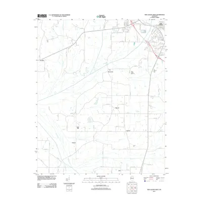
2012 Map of New Albany West
USGS Topo · Published 2012About this map
The Little Tallahatchie River meanders through this portion of Union County, defining the low-lying King Creek Bottoms and drawing together several small communities west of the regional hub of New Albany. This landscape is characterized by a network of rural county roads that connect established settlements such as Ingomar, Martintown, and Poolville. Local history is anchored by numerous burial sites, including the Union Hill Cem and Martin Cem, which suggest long-standing family ties to the land. The topography rises at Bald Hill, overlooking the drainage basins of Little Mud Cr and Hell Cr. This 2012 survey provides a clear look at the intersection of rural agriculture and the expanding residential corridors leading into the city, where the Po and New Albany Cem mark the historic center.
Find a feature on this map
103 named features on this map. Tap any name to fly to it.
Don’t see what you’re looking for? This feature index may not catch every label — zoom into the map to look around manually.
Map Details
Editions of this 2012 New Albany West Map
This is the sole edition of this map. No revisions or reprints were ever made.
Other maps of this area

1949 · New Albany
USGS Topo · 1:62,500

1951 · New Albany
USGS Topo · 1:62,500

1955 · Ripley
USGS Topo · 1:62,500

1955 · Sherman
USGS Topo · 1:62,500

1955 · Blue Mountain
USGS Topo · 1:62,500

1956 · Tupelo
USGS Topo · 1:250,000

1958 · Tupelo
USGS Topo · 1:250,000

1980 · Northwest Pontotoc
USGS Topo · 1:24,000
1980 · Thaxton
USGS Topo · 1:24,000

1980 · New Albany West
USGS Topo · 1:24,000