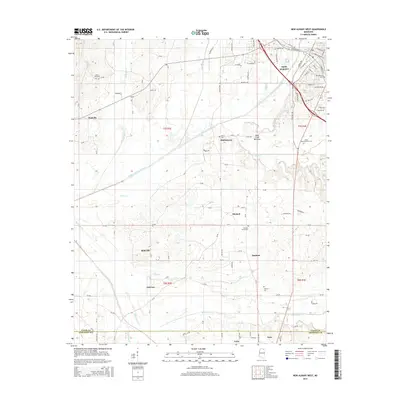
2015 Map of New Albany West
USGS Topo · Published 2015About this map
The Little Tallahatchie River bisects this landscape west of New Albany, carving out the broad King Creek Bottoms near the center of the survey. The terrain is a patchwork of small communities and rural family landmarks, ranging from Poolville in the northwest to Ecru and Cairo along the southern border. For genealogists, the map is remarkably dense with burial sites including Union Hill Cem, Martin Cem, and the Vista Memorial Park Cem, alongside the Pleasant Grove Cem and Ingomar Cem.
Find a feature on this map
144 named features on this map. Tap any name to fly to it.
Don’t see what you’re looking for? This feature index may not catch every label — zoom into the map to look around manually.
Map Details
Editions of this 2015 New Albany West Map
This is the sole edition of this map. No revisions or reprints were ever made.
Other maps of this area

1949 · New Albany
USGS Topo · 1:62,500

1951 · New Albany
USGS Topo · 1:62,500

1955 · Ripley
USGS Topo · 1:62,500

1955 · Sherman
USGS Topo · 1:62,500

1955 · Blue Mountain
USGS Topo · 1:62,500

1956 · Tupelo
USGS Topo · 1:250,000

1958 · Tupelo
USGS Topo · 1:250,000

1980 · Northwest Pontotoc
USGS Topo · 1:24,000
1980 · Thaxton
USGS Topo · 1:24,000

1980 · New Albany West
USGS Topo · 1:24,000