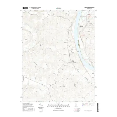
2016 Map of New Amsterdam
USGS Topo · Published 2016About this map
The Ohio River carves a deep valley along the state line between Indiana and Kentucky, defining the geography of this riverfront corridor. On the Indiana side, the small settlement of New Amsterdam sits near the confluence with Indian Creek, while across the water in Kentucky, the community of Battletown is perched on the high ground overlooking the river. The landscape is characterized by steep ridges and hollows, such as Buzzard Roost and Blue Spring Hollow, which have historically dictated the placement of roads like Battletown Rd and Cedar Flat Rd. Local history is preserved in numerous family and community burial grounds, including Crown Hill Cem, Bennett Cem, and Bell Knob Cem. Further inland from the river, small clusters of homes and farms are found at Liberty, Beechland, and Cedar Flat, reflecting a traditional rural settlement pattern that persists even into the twenty-first century.
Find a feature on this map
76 named features on this map. Tap any name to fly to it.
Don’t see what you’re looking for? This feature index may not catch every label — zoom into the map to look around manually.
Map Details
Editions of this 2016 New Amsterdam Map
This is the sole edition of this map. No revisions or reprints were ever made.
Other maps of this area

1928 · Hardinsburg
USGS Topo · 1:48,000

1931 · Hardinsburg
USGS Topo · 1:62,500

1931 · Corydon
USGS Topo · 1:62,500

1941 · Ekron
USGS Topo · 1:62,500

1944 · Corydon West
USGS Topo · 1:24,000

1946 · Leavenworth
USGS Topo · 1:24,000

1947 · Irvington
USGS Topo · 1:24,000

1947 · Lodiburg
USGS Topo · 1:24,000

1947 · Leavenworth
USGS Topo · 1:24,000

1947 · Corydon West
USGS Topo · 1:24,000