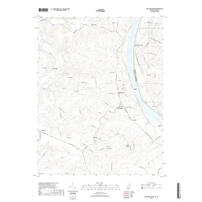
2019 Map of New Amsterdam
USGS Topo · Published 2019About this map
The Ohio River serves as the primary geographic dividing line in this area, separating Harrison County from Meade County. The terrain is defined by a series of prominent ridges and hollows, such as Turkey Heaven Ridge and Gas Well Hollow, which dictate the winding paths of rural roads like Whippoorwill Rd and Rhodelia Rd. Small communities such as New Amsterdam and Battletown sit near the river's edge, while inland settlements like Cedar Flats and Beechland occupy the higher ground near The Knob. For those researching local history, several family and community burial sites are documented, including Crown Hill Cem, Chism Cem, and Bell Knob Cem near Ball Knob. The map also illustrates the drainage network feeding into the Ohio, including Wolf Creek and Indian Creek.
Find a feature on this map
79 named features on this map. Tap any name to fly to it.
Don’t see what you’re looking for? This feature index may not catch every label — zoom into the map to look around manually.
Map Details
Editions of this 2019 New Amsterdam Map
This is the sole edition of this map. No revisions or reprints were ever made.
Other maps of this area

1928 · Hardinsburg
USGS Topo · 1:48,000

1931 · Hardinsburg
USGS Topo · 1:62,500

1931 · Corydon
USGS Topo · 1:62,500

1941 · Ekron
USGS Topo · 1:62,500

1944 · Corydon West
USGS Topo · 1:24,000

1946 · Leavenworth
USGS Topo · 1:24,000

1947 · Irvington
USGS Topo · 1:24,000

1947 · Lodiburg
USGS Topo · 1:24,000

1947 · Leavenworth
USGS Topo · 1:24,000

1947 · Corydon West
USGS Topo · 1:24,000