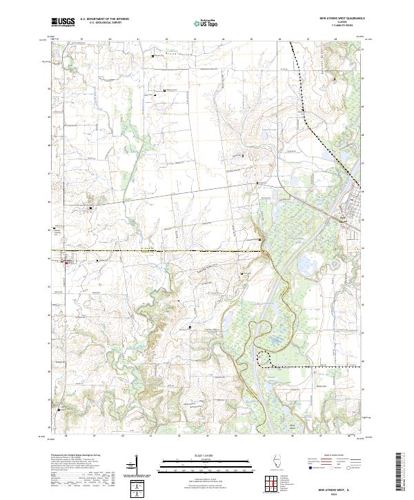
2024 Map of New Athens West
USGS Topo · Published 2024About this map
Hecker and New Athens anchor the western and eastern edges of this Illinois landscape, where the meandering Kaskaskia River defines the drainage patterns of both St. Clair and Monroe counties. The map captures a high density of small family and community burial grounds, such as Wiskamp Cem, Darmstatter Cem, and Koch Cem, which speak to the area's deep-rooted agricultural settlement. The terrain transitions from the elevated Belcher Ridge and Tamaraiva Ridge to the complex network of oxbows and sloughs along the river bottomlands, including Stubblefield Lake and White Cabin Slough.
Find a feature on this map
100 named features on this map. Tap any name to fly to it.
Don’t see what you’re looking for? This feature index may not catch every label — zoom into the map to look around manually.
Map Details
Editions of this 2024 New Athens West Map
This is the sole edition of this map. No revisions or reprints were ever made.
Other maps of this area

1910 · Waterloo
USGS Topo · 1:62,500

1912 · New Athens
USGS Topo · 1:62,500

1912 · Baldwin
USGS Topo · 1:62,500

1913 · Waterloo
USGS Topo · 1:62,500

1914 · Baldwin
USGS Topo · 1:62,500

1915 · Renault
USGS Topo · 1:62,500

1940 · Renault
USGS Topo · 1:62,500

1942 · Baldwin
USGS Topo · 1:62,500

1949 · Saint Louis
USGS Topo · 1:250,000
1954 · Freeburg
USGS Topo · 1:24,000